Select your product to confirm this information applies to you

Updates for Seasonal and Dynamic Management Areas for North Atlantic Right Whale Conservation

What Is a Whale Seasonal Management Area (SMA) or Dynamic Management Area (DMA)?

Seasonal Management Areas

SMAs are locations along the U.S. East Coast marked out along migratory routes, as well as calving and nursing areas for the endangered North Atlantic right whale. Most vessels 65 feet or longer must travel at 10 knots or less in certain locations (called Seasonal Management Areas) along the U.S. East Coast at certain times of the year. This mandatory regulation reduces the likelihood of deaths and serious injuries to endangered North Atlantic right whales that result from collisions with vessels. Vessels of all sizes can strike a whale, so we encourage vessels less than 65 feet long to help protect right whales by slowing to 10 knots or less within these areas as well.

Dynamic Management Areas

Right Whale Slow Zones and DMAs are voluntary programs used to notify vessel operators to slow down to avoid right whales. DMAs are based on visual sightings of three or more right whales within a discrete area. Right Whale Slow Zones are based on both visual and acoustic triggers. These areas are then uploaded to our chart data and updated every 15 days, as DMAs and Slow Zones are listed for 15 days after whales are detected. 

You can find more information online by going to https://www.fisheries.noaa.gov/.

Garmin Navionics charting now includes DMAs updated on the government's 15-day reporting cycle. Notifications are provided with latitude and longitude points, as well as indicated on a map.
Office of Protected Resources, "Reducing Vessel Strikes to North Atlantic Right Whales," October 15, 2024, https://www.fisheries.noaa.gov/national/endangered-species-conservation/reducing-vessel-strikes-north-atlantic-right-whales

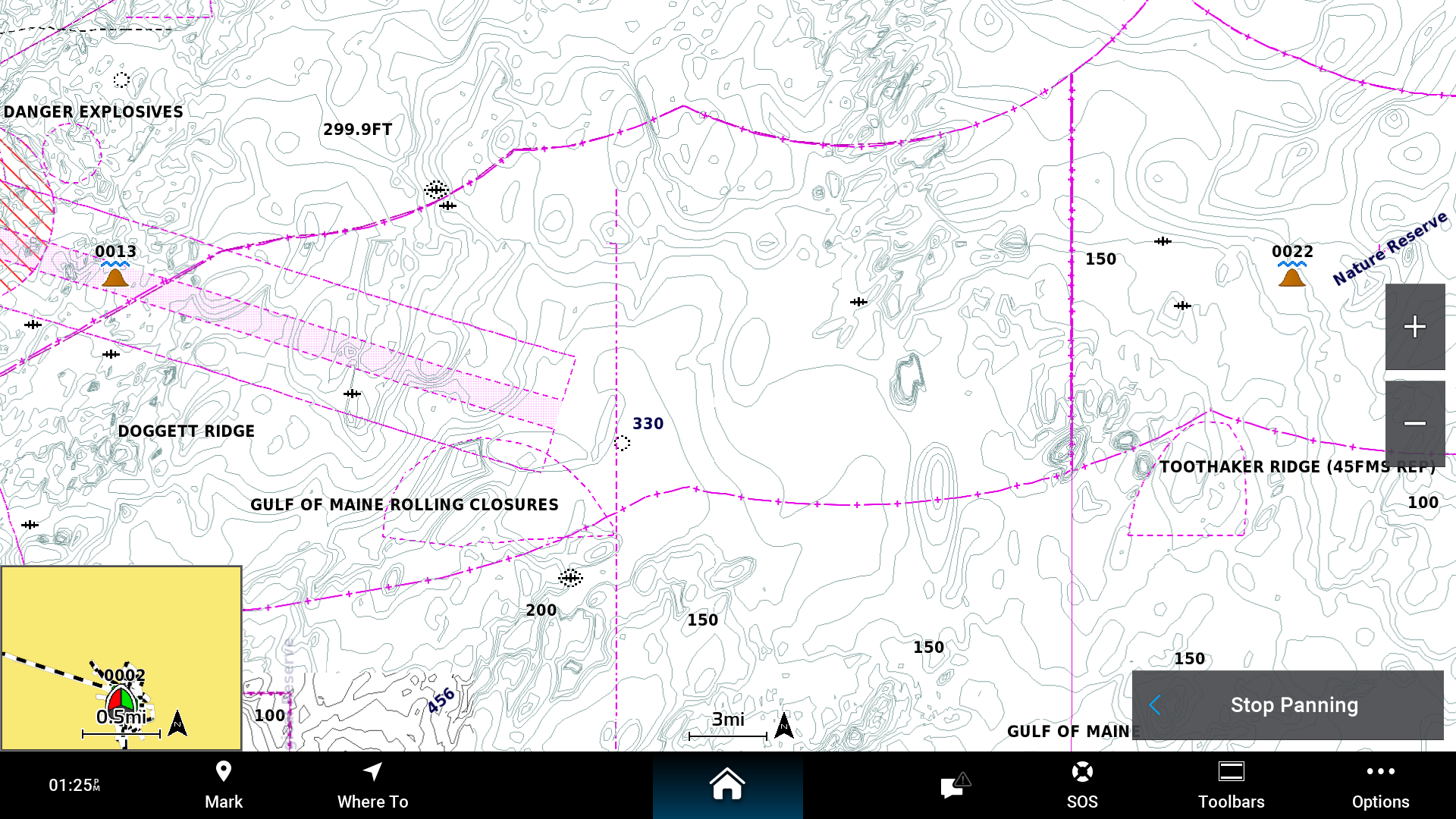
Chart Information Before and After

Chart data before update including new DMA data.Chart data before update including new DMA data. 
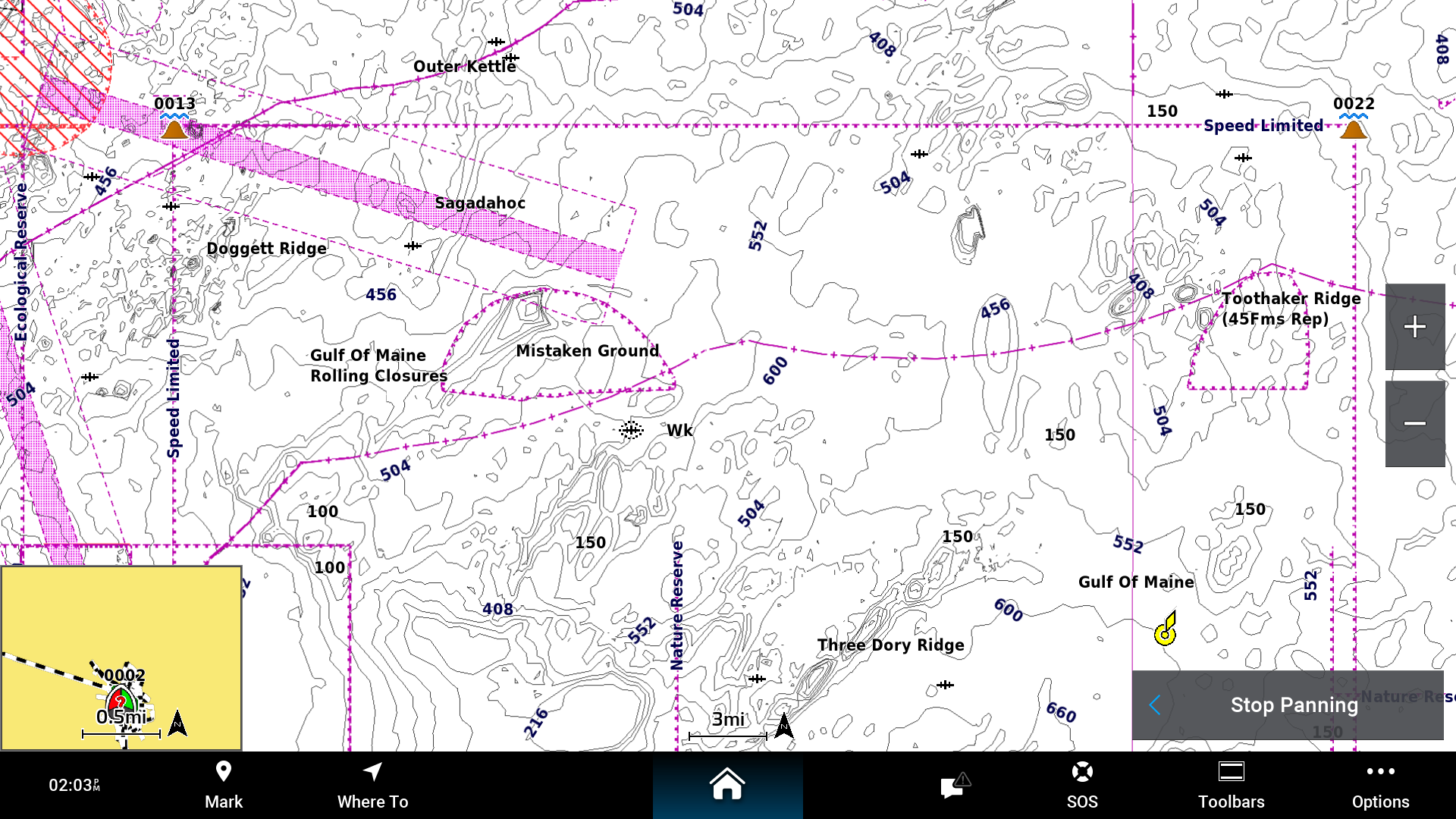
Chart data after update including new DMA data. Chart data after update including new DMA data.


DMAs in the Chart Data - What Can I Do?

Once you have determined there is a DMA or Slow Zone in the area you will be navigating, Garmin-brand chartplotters include a boundary feature, allowing you to be proactive about respecting the intent of the DMA rules. Notify yourself to slow down with a simple alarm.

Setting Boundaries and Alarms

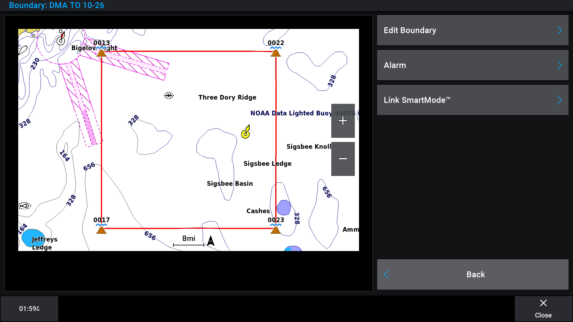
Boundary box placed on chart to highlight DMA for awareness. 

You can create boundary areas, lines, and circles using the map. You can also convert saved routes into boundary lines. You can create a boundary area using waypoints by creating a route from the waypoints and converting the route into a boundary line.

Creating and Saving a Route

You can add up to 250 turns to one route.

  1. Select Where To > Routes > New
  2. Select the starting waypoint of the route from your waypoint list.
  3. Select Add Turn.
  4. Select the waypoint of the next turn.
  5. Select Add Turn.
  6. If necessary, repeat steps 4 and 5 to add more turns.
  7. Select Done

Converting a Route to a Boundary

  1. Select Where To > Routes.
  2. Select a route.
  3. Select Review > Edit Route > Save as Boundary.

Editing a Boundary

  1. Select Where To > Boundaries.
  2. Select a boundary.
  3. Select Review.
  4. Select an option:
    • To edit the appearance of the boundary on the chart, select Display Options.

    • To change the boundary lines or name, select Edit Boundary.

    • To edit the boundary alarm, select Alarm.

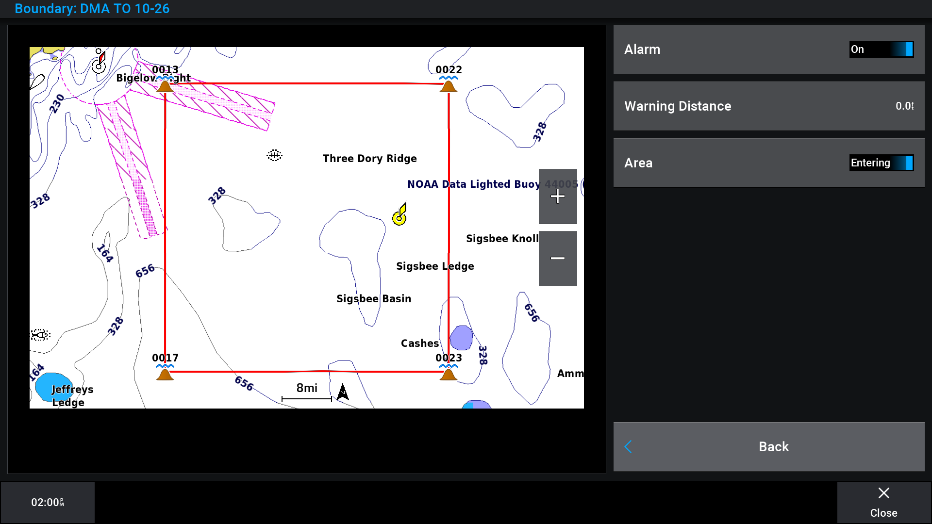
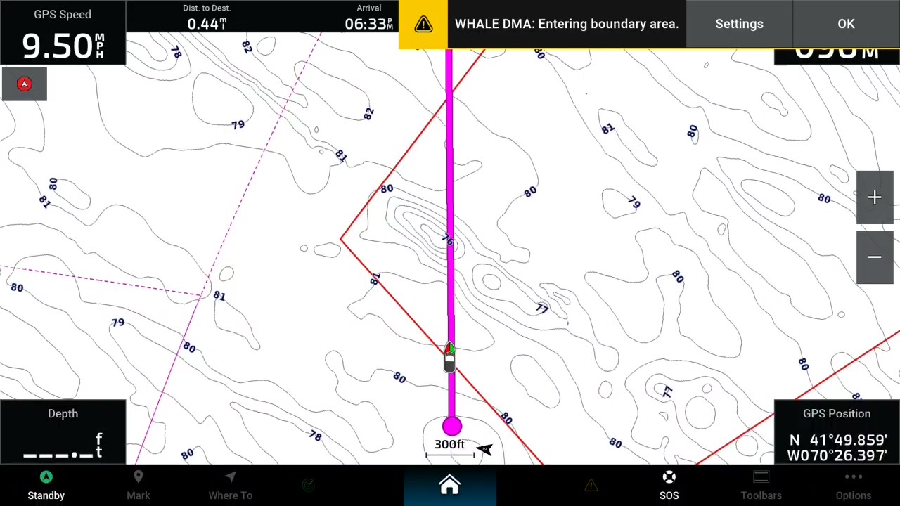
Alarm notification on chartplotter indicating entering boundary area.


Setting a Boundary Alarm

Boundary alarms alert you when you are within a specified distance of a set boundary. This can be helpful when attempting to avoid certain areas or when you should be very alert in certain areas.

  1. Select Where To > Boundaries.
  2. Select a boundary.
  3. Select Review > Alarm.
  4. Select an option:
    • To set an alarm for when your boat is a specified distance from the boundary, select Warning Dist., enter a distance, and select Done.

    • To set an alarm for when you enter or exit an area boundary or a circle boundary, select Area to show Entering or Exiting.

Boundary alarm menu (step number 2)


Updating Your Charts

Dynamic Management Areas, Slow Zones, as well as all updated chart information and overlays are available during an active subscription for your marine chart.
DMAs and Slow Zones are updated on a 15-day cycle, as new sightings or acoustics are reported. These will show as restricted areas in the chart data.

Updating Marine Charts for Garmin Chartpotters

Downloading and Updating Charts With ActiveCaptain®

These locations are also included with updates for Navionics®+, Navionics Platinum+™ marine chart cards, as well as the Navionics Boating app.

Updating Marine Charts for Other Chartplotter Brands (Non-Garmin)